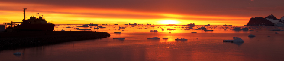
Earlier in the week we had our orca show, yesterday this was the view of the top of our boat ramp:

A group of elephant seals lounges at the top of the Palmer Station boat ramp.
In fact that view hasn’t changed. From the science office I can just make out the penguin colony on Torgersen Island, and there are plenty of their flying relatives around. Does every bay on the Antarctic Peninsula look like this? Or is there something special about the location of Palmer Station?
The answer is a little of both. Certainly the West Antarctic Peninsula has more marine megafauna than just about anywhere else on Earth. My experience from the Palmer LTER cruise two years ago was that seals and penguins are fairly ubiquitous along the coast. That is not to say that they are equally distributed however, and the site for Palmer Station was selected in part for the high concentration of animals here – perhaps most visibly the Torgersen Island penguin colony.

The bathymetery of Monterey Canyon, terminating at the Salinas River at the head of the bay. Image from the website of the Naval Postgraduate School at https://savage.nps.edu/Savage/Locations/MontereyBayCalifornia/_pages/page03.html.
A lot of work has gone into understanding how and why marine fauna is distributed along the West Antarctic Peninsula, and this has given rise to what is called the canyon hypothesis. Anyone who’s ever been to Monterey Bay, California or read John Steinbeck’s famous novel Cannery Row is already familiar with the role that submarine canyons can play in marine ecology. In the case of Monterey Bay dense schools of sardines congregate (or rather congregated, before they were all fished out) at the head of a deep marine canyon that cuts across the continental shelf. Sardines, much like krill in the Antarctic, are a critical intermediate in the food web, being small enough to feed on nearly-microscopic plankton and large enough to serve as a practical food source for big predatory fish, seals, and whales.
Sardines concentrate at the head of Monterey Canyon because their food source concentrates there. If we follow that logic further down the food web we reach a point where abundant nutrients, namely phosphorous, nitrogen, and silicate, support the growth of phytoplankton. These are fed on by small zooplankton, which in turn are fed on by sardines, and the biomass is slowly channeled up the foodweb. So the distribution of megafauna is dependent on the distribution of nutrients, but what do canyons have to do with all this?
Throughout the world’s oceans deep water is generally more nutrient rich than surface water. In the photic zone, the portion of the water column that has enough light to support photosynthesis, nutrients are quickly used up by phytoplankton. By contrast in the deep, dark ocean there is no photosynthesis, and the bacterial degradation of organic matter sinking out of the photic-zone releases a considerable fraction of these nutrients back into the water column. Generally the deeper the water the older it is, and the longer it has had to accumulate nutrients. Places in the ocean where this deep, nutrient-rich water reaches the surface are highly productive and are often famous for their fisheries.

Coastal upwelling sites, where nutrient-rich deep water is returned to the photic zone. Figure taken from Capon and Hutchins, 2013. Notable upwelling sites are circled in white and include the (clockwise from top-left) California current, Canary, Benguela, and Peruvian upwelling systems.
Much of this upwelling of deep nutrient-rich water is caused by a geophysical phenomenon called Ekman transport. Locally however, marine canyons can provide an additional opportunity for upwelling by channeling deep water onto and across the continental shelf. Returning to Palmer Station, let’s take a look at the bathymetery of Arthur Harbor:

The Bathymetry of Arthur Harbor, reconstructed from data collected by Philippe Tortell. Depth is given by color and shown in meters. Station B, one of the regular LTER sampling sites, is shown by an open circle (Station E, our other regular sampling site, is off the map along a trajectory 160 degrees from Station B). The green area that terminates at Station B is the head of a network of marine canyons.
We have nothing like the detailed bathymetery of Monterey Canyon, probably one of the best-studied submarine canyons in the world, but you don’t need ultra-high resolution to make out the network of submarine canyons snaking into Arthur Harbor. These canyons don’t cut to the phenomenal depth of Monterey Canyon, but due to the unique setting of the coastal Antarctic they don’t need to. Away from the immediate coastal area surface waters around Antarctica are iron limited. This is the result of limited dust deposition and a lack of rivers. Because of this iron limitation nitrogen, silicate, and phosphate are less likely to be drawn down. Submarine canyons along the West Antarctic Peninsula are able to channel intermediate-depth nutrient-rich water from offshore areas right into coastal bays and fjords. The result is a convergence of iron-rich nearshore water and macronutrient-rich offshore water and high biological productivity.

Ashley and Chelsea take one of the Schofield group’s gliders for a test swim in advance of deployments later this month.
Of course the penguins and seals know all this, but it’s taken us a while to figure it out. Oscar Schofield‘s group in the Palmer LTER project has done some really amazing work with gliders to validate the canyon hypothesis; tagging penguins from Torgesen Island and programming gliders equipped with bio-optical sensors to follow the penguins to their feeding grounds. Not surprisingly the penguins feed on krill that congregate at the head of the submarine canyon, just as sardines congregate in Monterey Bay. We are still data-limited for much of the West Antarctic Peninsula, but there seems to be a remarkable correlation between the locations of penguin colonies and major submarine canyons, suggesting that the canyon hypothesis is not limited to Arthur Harbor.
As I’m writing this Nicole, Ashley, and Chelsea are back at Station B in an attempt to return to our bi-weekly sampling program. Boating was shut down for most of the week from ice and/or high winds, and winds and warmer temperatures have finally succeeded in breaking up much of the fast ice in Arthur Harbor. After six weeks our ice station is finally gone, and in less than two weeks Jamie and I will be gone as well!

Hello, I am interested in reading more about the canyon hypothesis discussed in this posting. However, the link in this article is broken. Do you have the information from this page?
Try here and here.